
Quantify critical interactions and feedbacks among California’s wildlands, storage, and croplands subsystems. Models of hydrology, energy, and agricultural will be integrated using Envision, a GIS-based, spatially explicit, multiparadigm modeling framework for analysis of CHANS and alternative future scenarios. This will advance integrated process understanding by identifying: interactions, feedbacks, nonlinearities, and thresholds within these subsystems and California’s FEWS as a whole.
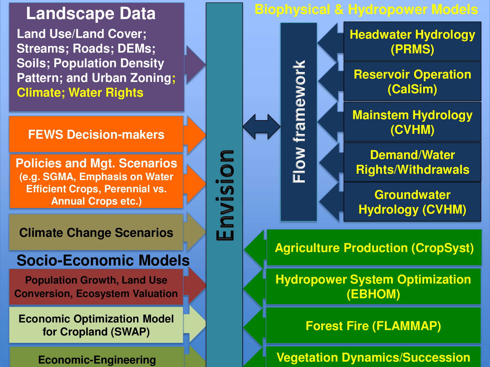
Each of these ENVISION components are definable by application developers for specific applications. An Envision application consist of definitions for each of the components - landscape data, change models, and optionally, evaluative models, actors, and policies.
